.svg)
.svg)
AI and space technology driven large scale crop data
Features
Crop identification
Crop identification
Crop identification
Crop identification
Crop identification
Crop identification
Crop identification
Crop identification
Specifications
80% - 95% accuracy
Visualised by country, state, province, districts or customised zones & territories
Get Started
.png)
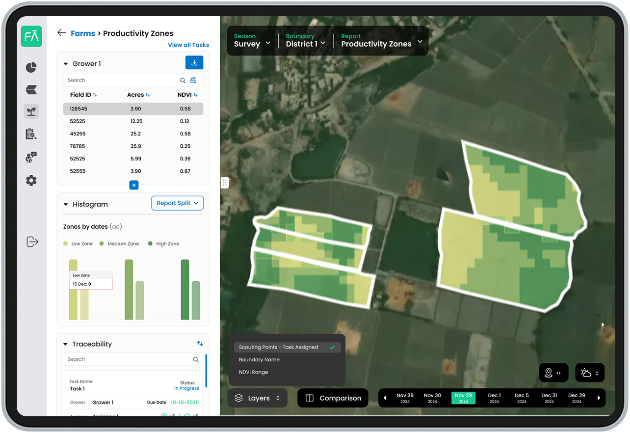
Yield Prediction
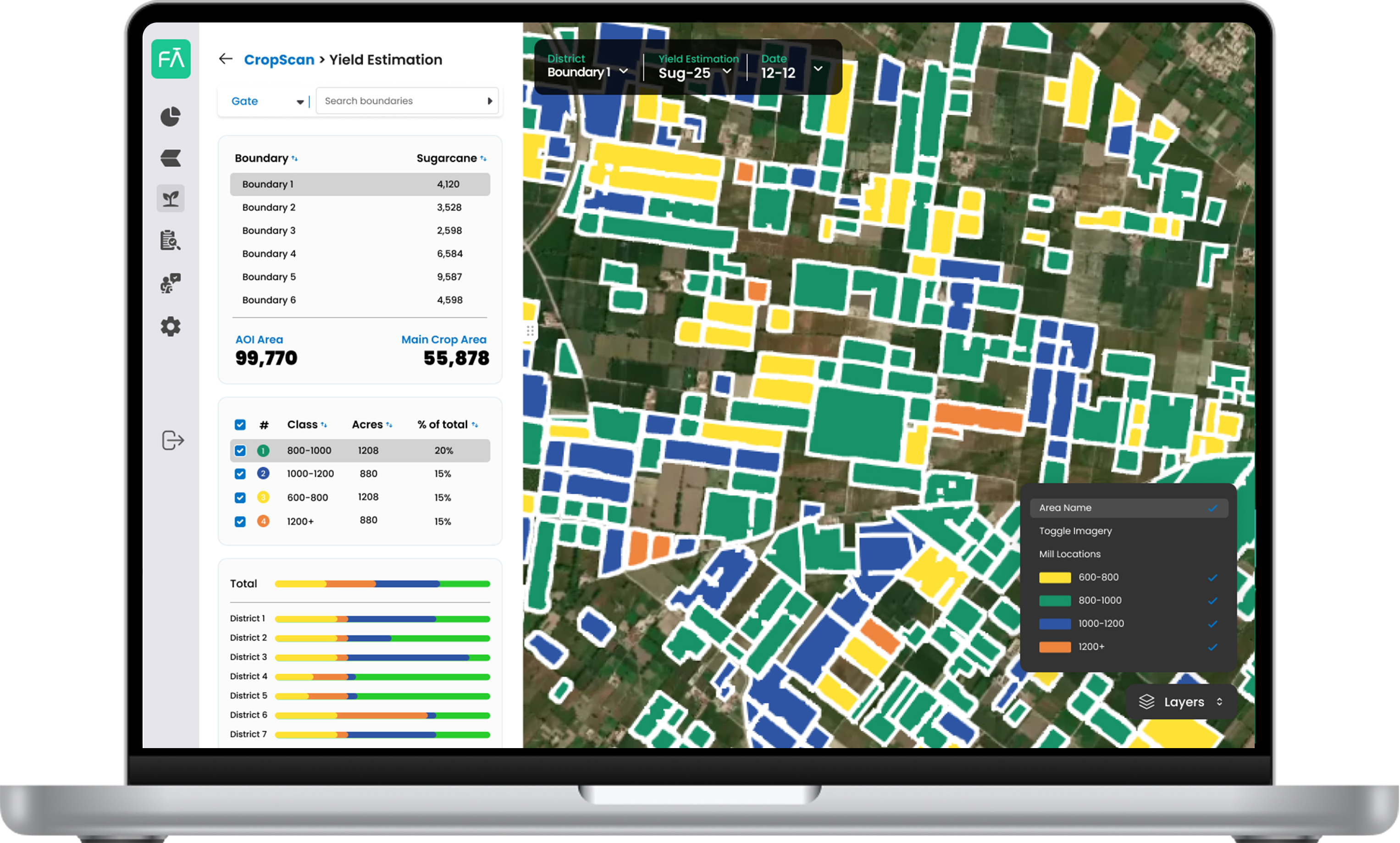
We forecast yields early and often using a combination of space-based data and weather inputs. CropScan offers two methods: deep learning where historical data exists and biomass modeling where it doesn't. These estimates help clients plan procurement, pricing and supply chain operations with greater accuracy.
Crop Detection
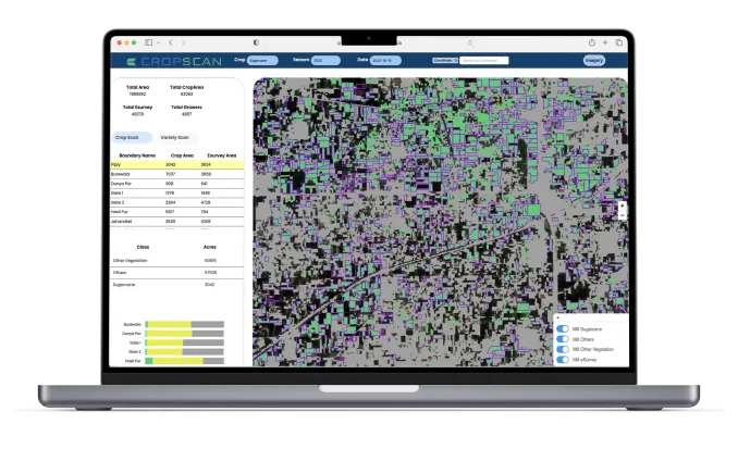
CropScan uses space technology and AI to automatically identify crop types across vast areas. This enables agribusinesses, mills and governments to gain clear visibility on what is growing where, eliminating guesswork and reducing reliance on field surveys. Our detection is updated regularly to track changes across the season.
Harvest Monitoring
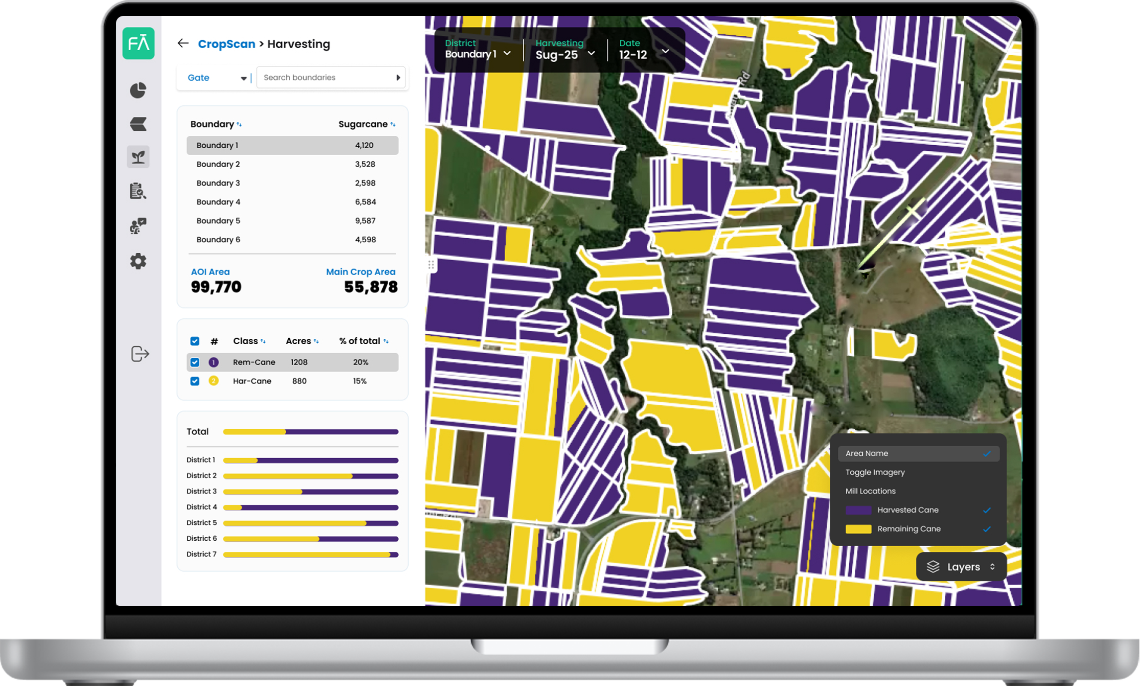
With CropScan you can monitor harvest progress in near real time. Our system detects when harvesting begins, tracks how much area has been cleared and flags unexpected delays. This helps procurement teams plan better logistics, avoid mill downtime and respond quickly to disruptions.
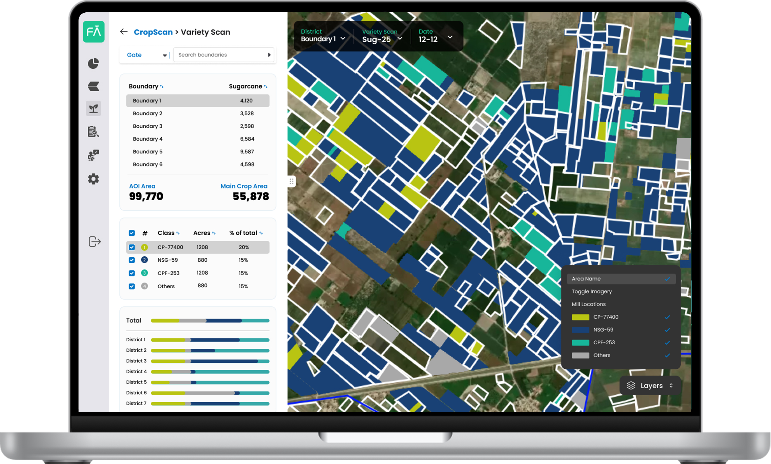
Variety Detection
Different crop varieties perform differently but often look the same from the ground. CropScan uses AI trained on space technology imagery to differentiate between crop varieties based on growth behavior, allowing clients to map high-performing areas and make informed decisions for future sowing.
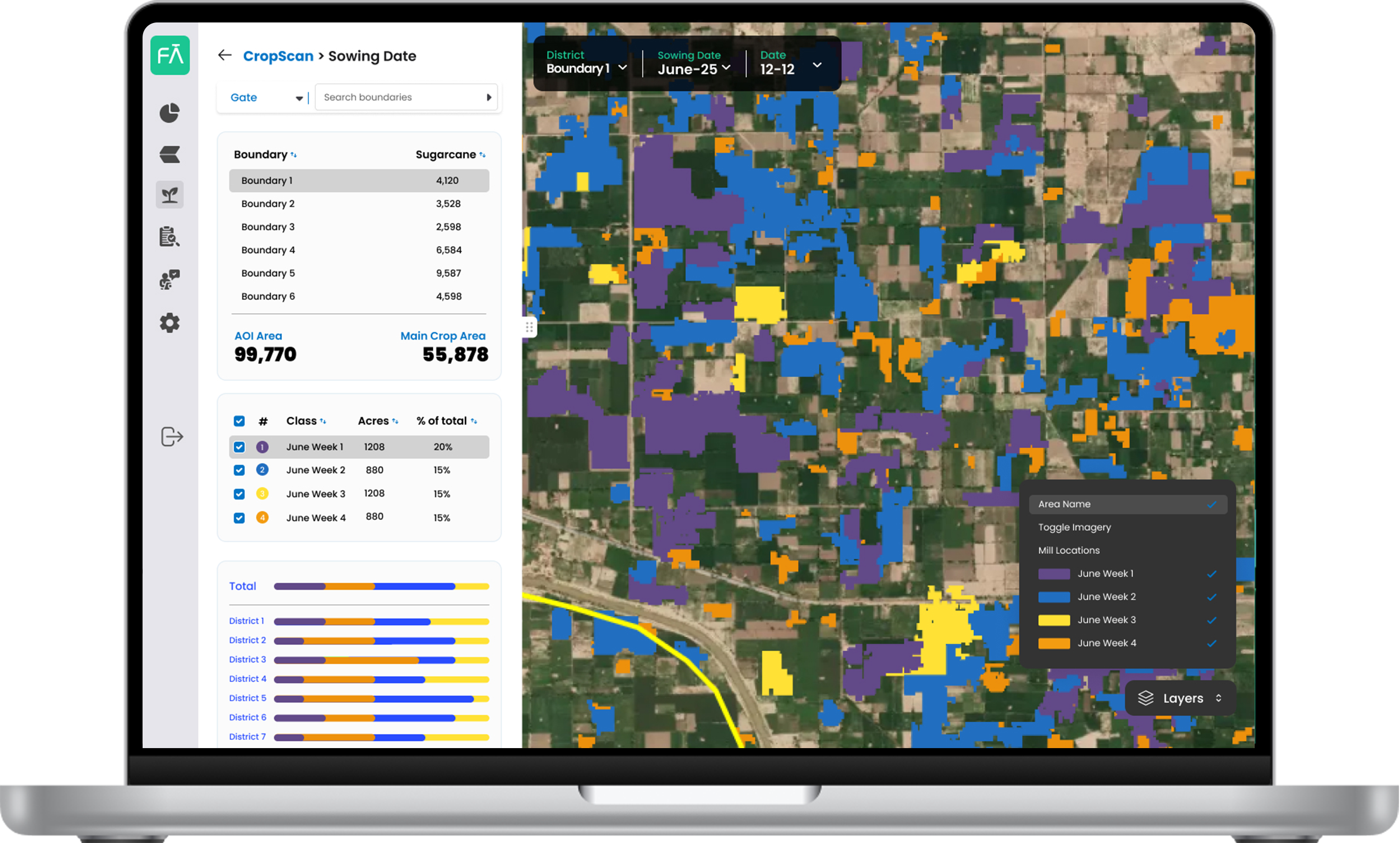
Sowing Time Analysis
Knowing when fields were planted helps predict harvest windows, understand performance and detect anomalies. CropScan estimates sowing dates using time-series analysis from space technology, giving agribusinesses the ability to monitor planting trends, plan resources and reduce surprises at the end of the season.
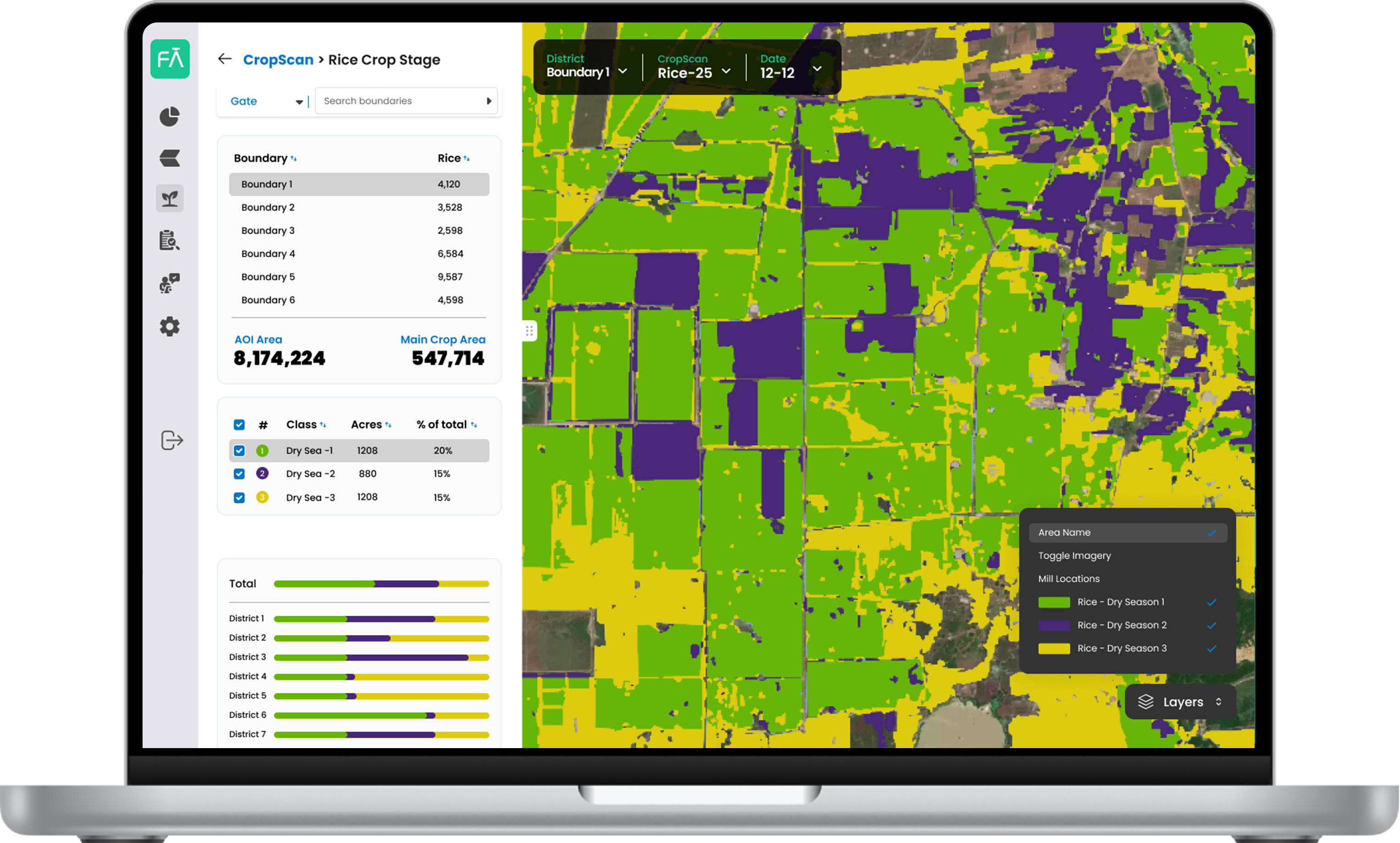
Crop Stage Detection
CropScan uses AI and satellite intelligence to identify and track field-level crop stage detection across large areas throughout the growing cycle. This enables agribusinesses to understand crop progression, monitor growth variability, and plan interventions or sales and marketing activity with greater accuracy. Stage detection updates provide continuous visibility to support timely agronomic and business decisions.
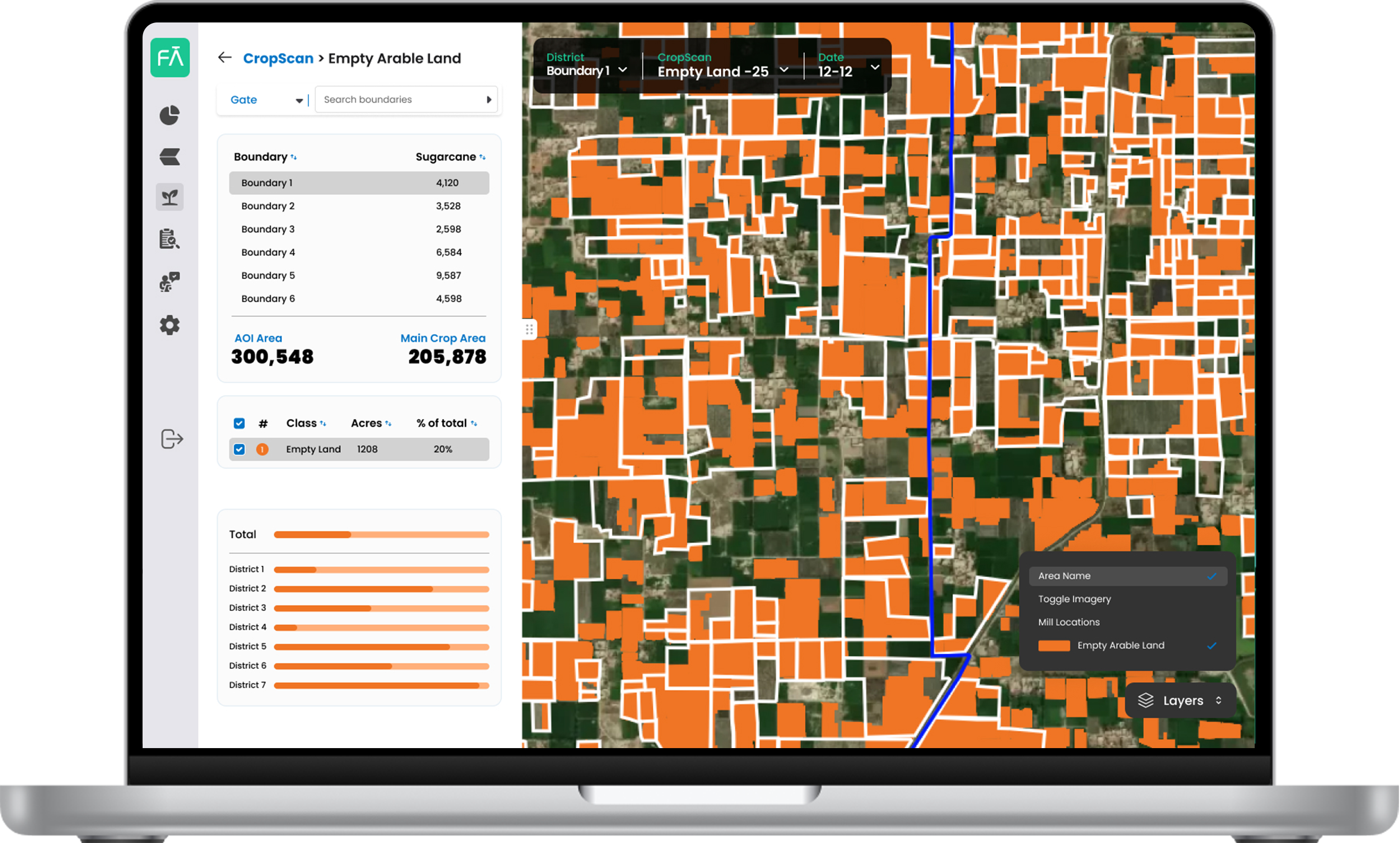
Empty Arable Land
CropScan uses AI and satellite intelligence to automatically identify and classify empty arable land across large regions. This enables agribusinesses to understand where cultivable land remains, reduce reliance on manual surveys, and make informed decisions around sales planning, business expansion, crop conversions, and resource allocation.
.png)
Firebird Field Delineation
Firebird is Farmdar’s AI-powered field delineation module that creates accurate digital field boundaries at scale, supporting cleaner field records and stronger downstream analytics.
Key capabilities
Large-scale field boundary extraction with high consistency
Supports faster onboarding of growers and field programs
Creates cleaner geo-referenced boundaries for planning and execution
.svg)
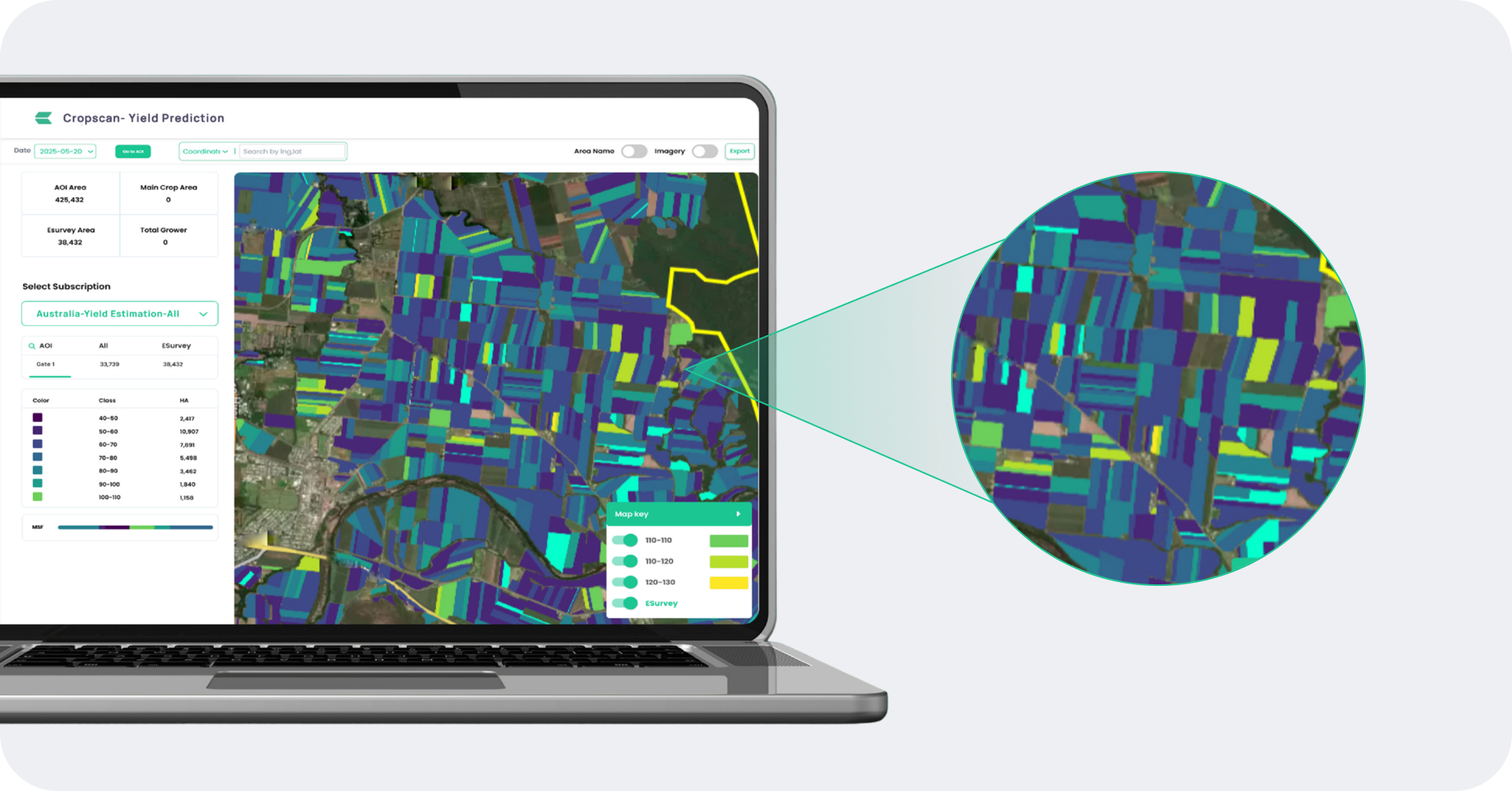
Plant Health
Monitor overall crop health
Identify areas of good and poor plant health
Focus efforts on specific areas rather than a blanket approach
Track and improve health of crops resulting in better quality and yields
Remote monitoring of farms
Get Started
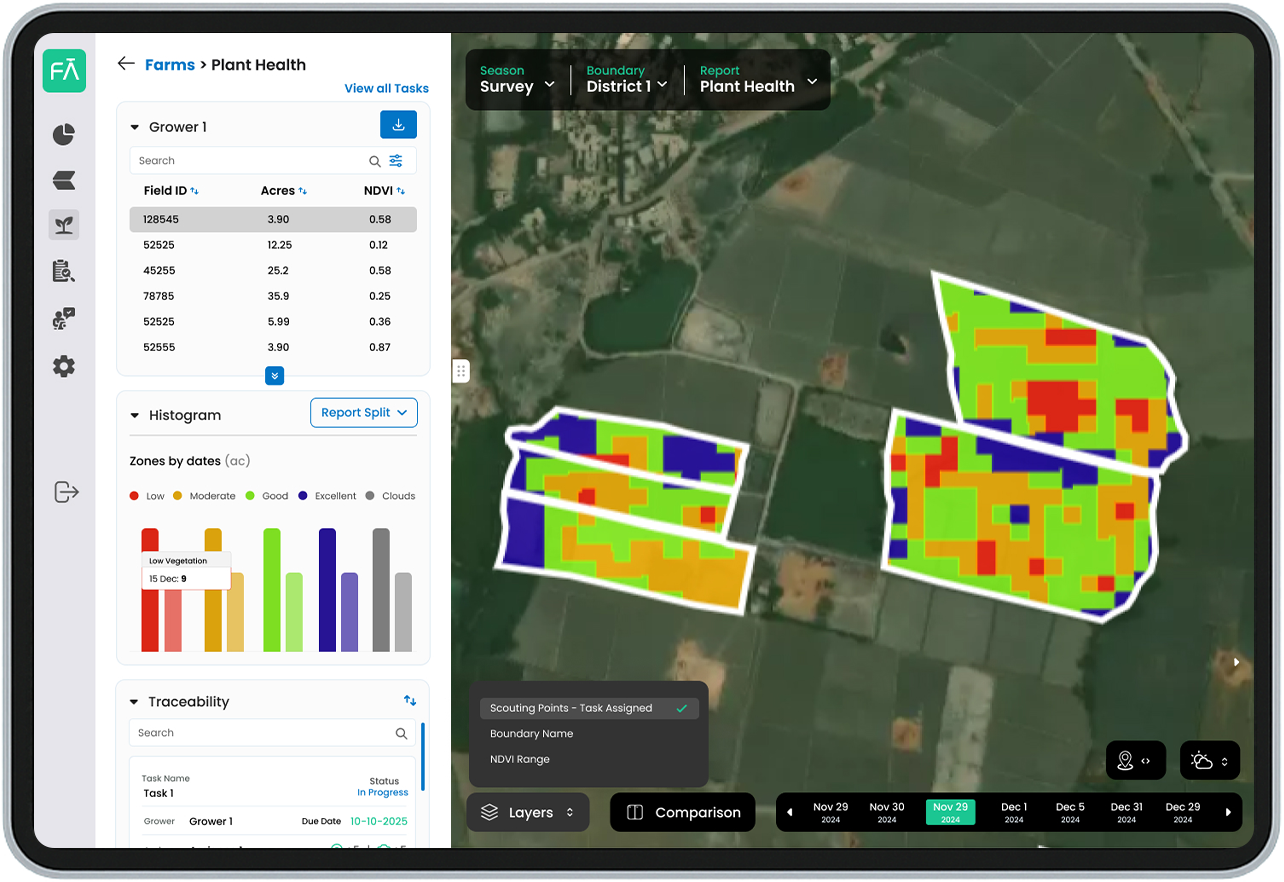
Plant Stress
Identifies existing and potential crop stress
Identify which crops are under stress and which ones are likely to be under stress in the future
Focus efforts on specific areas rather than a blanket approach
Get Started
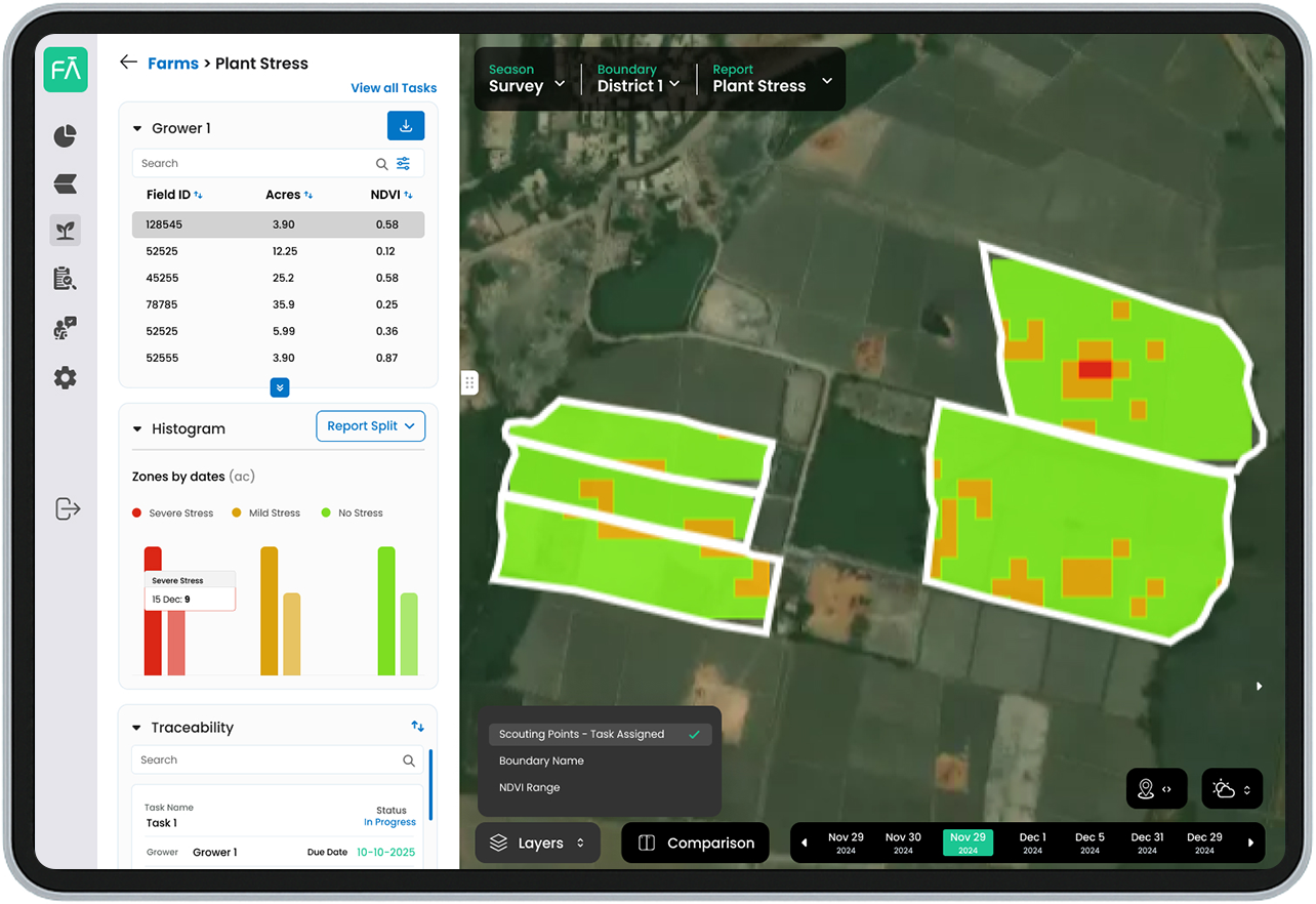
Productivity Zones
Identify historically productive zones
AI-backed using 5-year historical satellite imagery
Identifies productivity zones by high, medium and low ranges
Isolate areas for intervention
Select the most productive fields intelligently
Allows farmers to apply P&K intelligently
Get Started
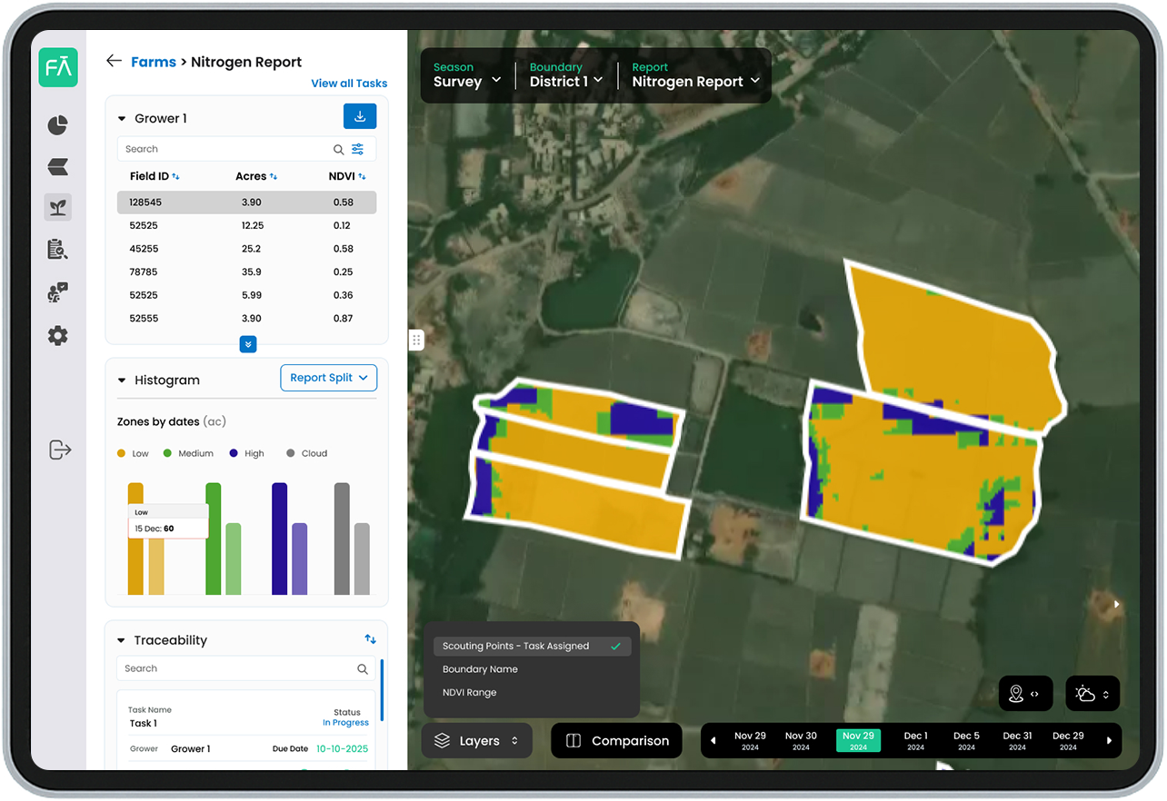
Nitrogen Zones
Identifies precise nitrogen requirement of crops
Identify areas of high, medium and low Nitrogen requirement
Based on AI and satellite imagery analysis of plant chlorophyl content
Enables reduction of environmental impact of Nitrogen
Get Started
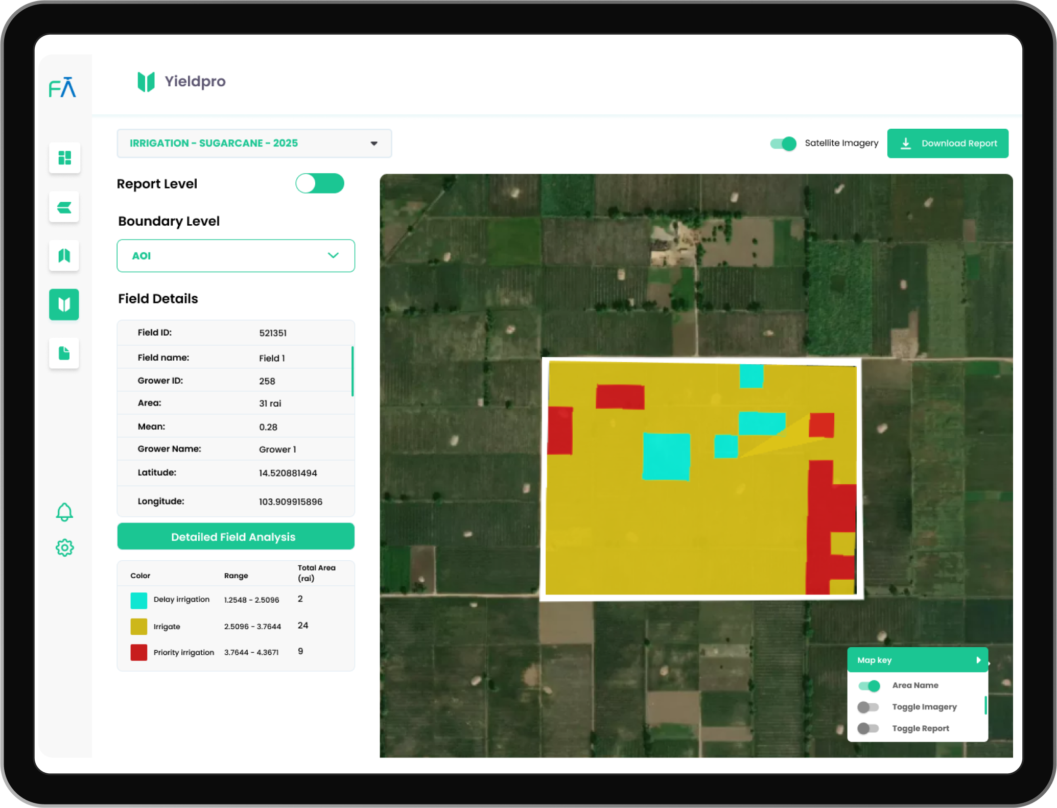
Moisture Report
Track early germination performance
Identify fields with healthy vs weak crop establishment early in the season
Enable targeted field follow-up for replanting, advisory, and intervention
Improve in-season decision quality by linking emergence performance with yield planning
Get Started
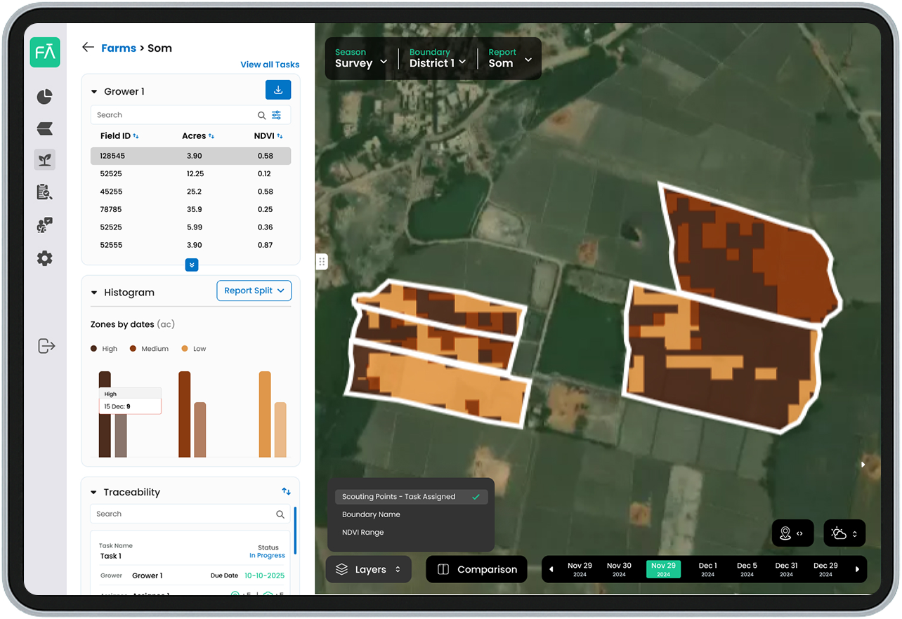
Soil Organic Matter
Identify zones of high and low organic matter
In the SOM analysis, black represents areas where organic matter is good, while grey and white represents the areas with medium and low organic matter quality
High yield productivity area corresponds with good SOM
Identifying zones of low, medium and high SOM allows focused areas for soil improvement efforts
Get Started
<
>
.svg)

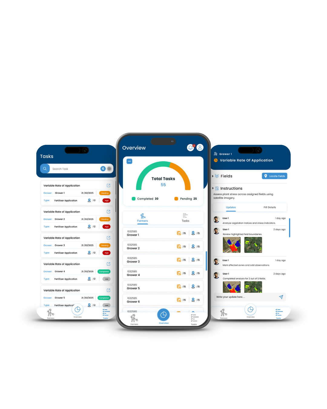
Customisable, pre-loaded crop development activity calendar, with task assignment, scheduling and audit for field managers:
Features
Assign tasks to field staff employees for each sector, and track the status of each task
Integrate eSurvey data for grower wise monitoring of farming practices from seed-to-harvest
Receive real time grower feedback and surveyor remarks regarding diseases, and pests in specific areas to flag to other growers
Get Started
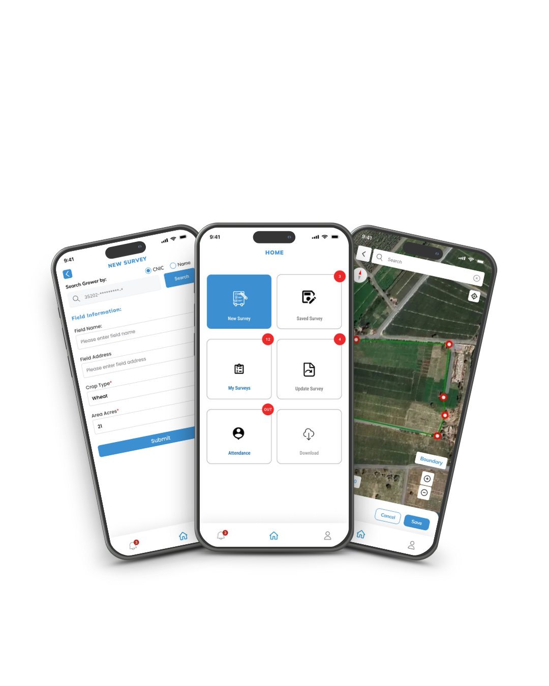

Customizable, pre-loaded crop development activity calendar, with task assignment, scheduling and audit for field managers:
Features
Assign tasks to field staff employees for each sector, and track the status of each task
Integrate eSurvey data for grower-wise monitoring of farming practices from seed-to-harvest
Receive real-time grower feedback and surveyor remarks regarding diseases, and pests in specific areas to flag to other growers
Get Started
<
>
Find out how global agri business experienced our products
With Farmdar’s wide depth of products, there are many ways you can optimize your business efficiency, easily and immediately. Request a consultation or book a demo, we look forward to hearing from you.
.svg)


.svg)
.svg)
.svg)
.svg)